Osney towpath flooding information
This one is largely thanks to Anu Dudhia.
It’s no secret that I work on the Osney Mead Industrial Estate. And the most direct route, on a bicycle or on foot, between home and there, involves the section of the Thames Path directly south of Osney Lock:
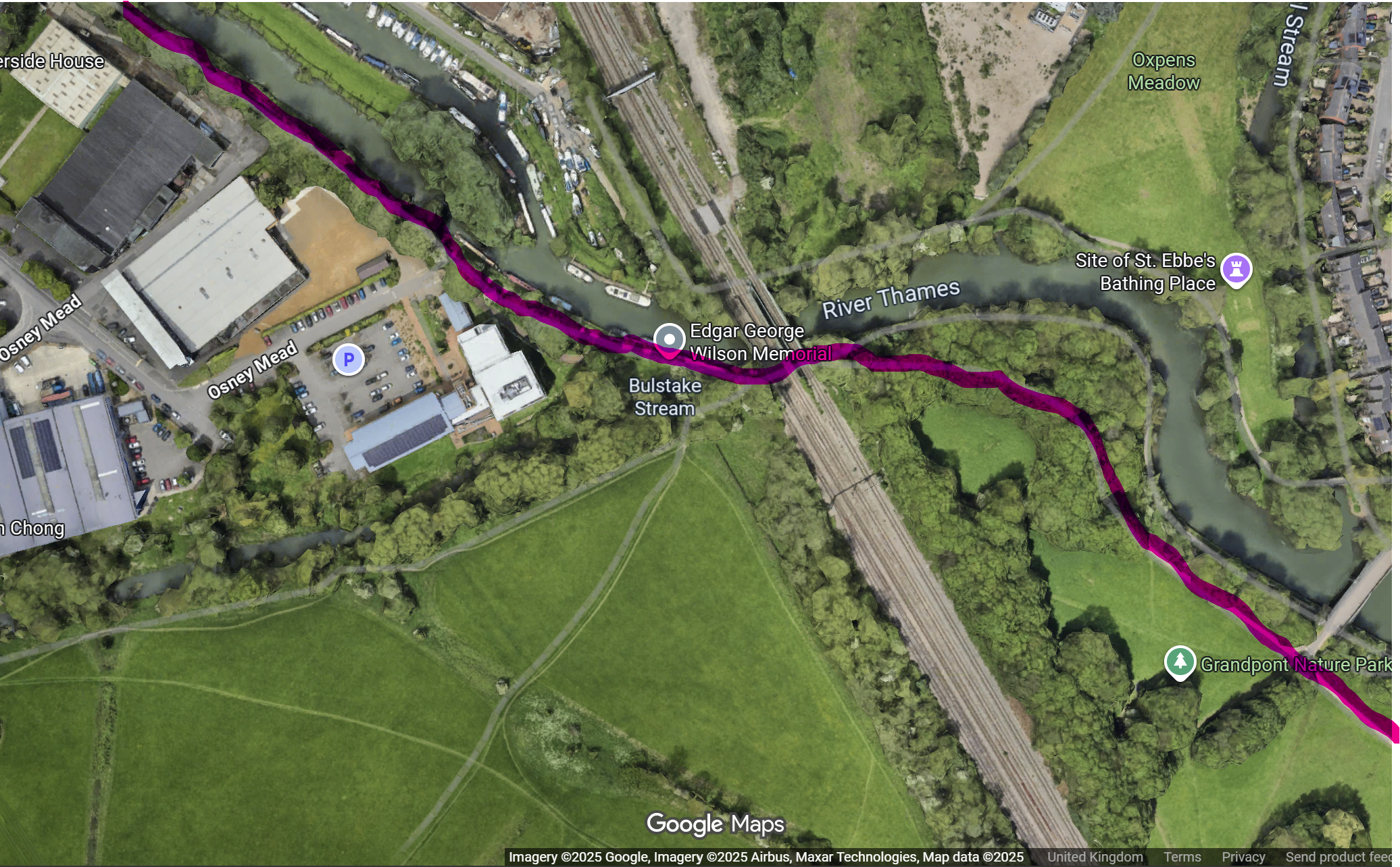
But, being right next to the R. Thames, this path can end up under water when the river rises.
Inspired by it raining like the end of the world last week, a visitor asked “why isn’t the towpath flooding information on your e-paper display by the front door, David?”
Why not indeed.
Anu’s page, linked above, has a diagram which provides this information, and it links through to the primary source - the gov.uk website provides CSVs from the Environment Agency’s river height monitors, and you can grab the CSV of recent measurements from Osney Lock.
What that doesn’t tell you, though, is how far above the river bed the relevant section of the path is. Fortunately, to spare myself going down there with a tape measure, I e-mailed Anu, and he kindly replied almost at once. According to his notes from previous years, the path next to the Osney Mead Industrial Estate is 3.4m above the base of the river, so take 3.4m away from river height to find out if it’s underwater and by how much.
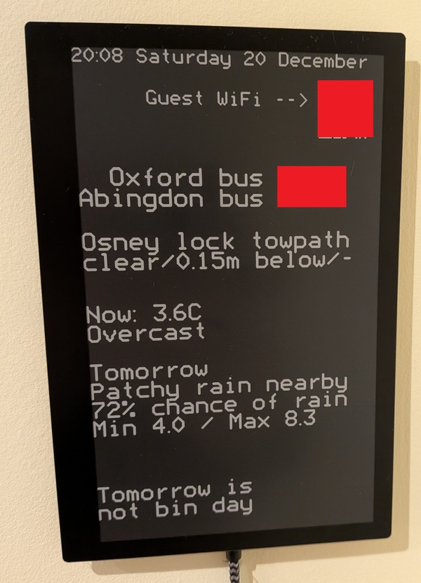
Finished result: